
JOHN HENRY’S MARINA
Annual Moorage
JOHN HENRY’S MARINA
Annual Moorage
John Henry’s Marina is located inside Pender Harbour, in historic Hospital Bay.
The marina is an ideal waypoint for mariners traveling north to visit
Princess Louisa Inlet, Desolation Sound, the Broughtons, or points further north. We are a 40 slip marina with over 2000 lineal feet of dock space, ranging from 32 to 80 feet moorage slips. Docks are all brand new as of May 2023. Float plane dock, renovated laundry and washroom facilities. Upgraded security and wifi on site. Also a transient revenue sharing program for our annual guests.
Marina Amenities
- Clean washrooms & hot showers
- Complimentary WiFi
- Self-serve coin-operated laundry
- Garbage & recycling bins nearby
- Large on-site general store (with groceries, dairy & eggs, propane, gifts), seasonal Café, Ice Cream Cones and much more
- Canada Post Office
- Moorage available (advance reservations strongly recommended during the summer months)
- Marine fuel dock with gas and diesel – $.03 per litre discount available to moorage guests.
Use the button below to start you application.
Fill out the PDF form and email your form to info@johnhenrys.ca

2026 Annual
Moorage Rates
Moorage is available year-round. A limited amount of annual & seasonal moorage is available (direct inquiries to: Allyson at johnhenrys dot ca).
Moorage Rates
Annual Moorage
Jan 1 – Dec 31, 2026
32 foot slips $15.00 per foot per month
40 foot slips $15.50 per foot per month
45 foot slips $16.00 per foot per month
50 foot slips $17.00 per foot per month
60 foot slips $18.00 per foot per month
70+ foot slips $18.50 per foot per month
80+ foot slips $19.00 per foot per month
+ 5% GST on all rates
Power
30 AMP or 50 AMP
30 AMP Billed usage per month* All boat sizes
50 AMP Billed usage per month* All boat sizes
+ 5% GST on all rates, *Metered Monthly
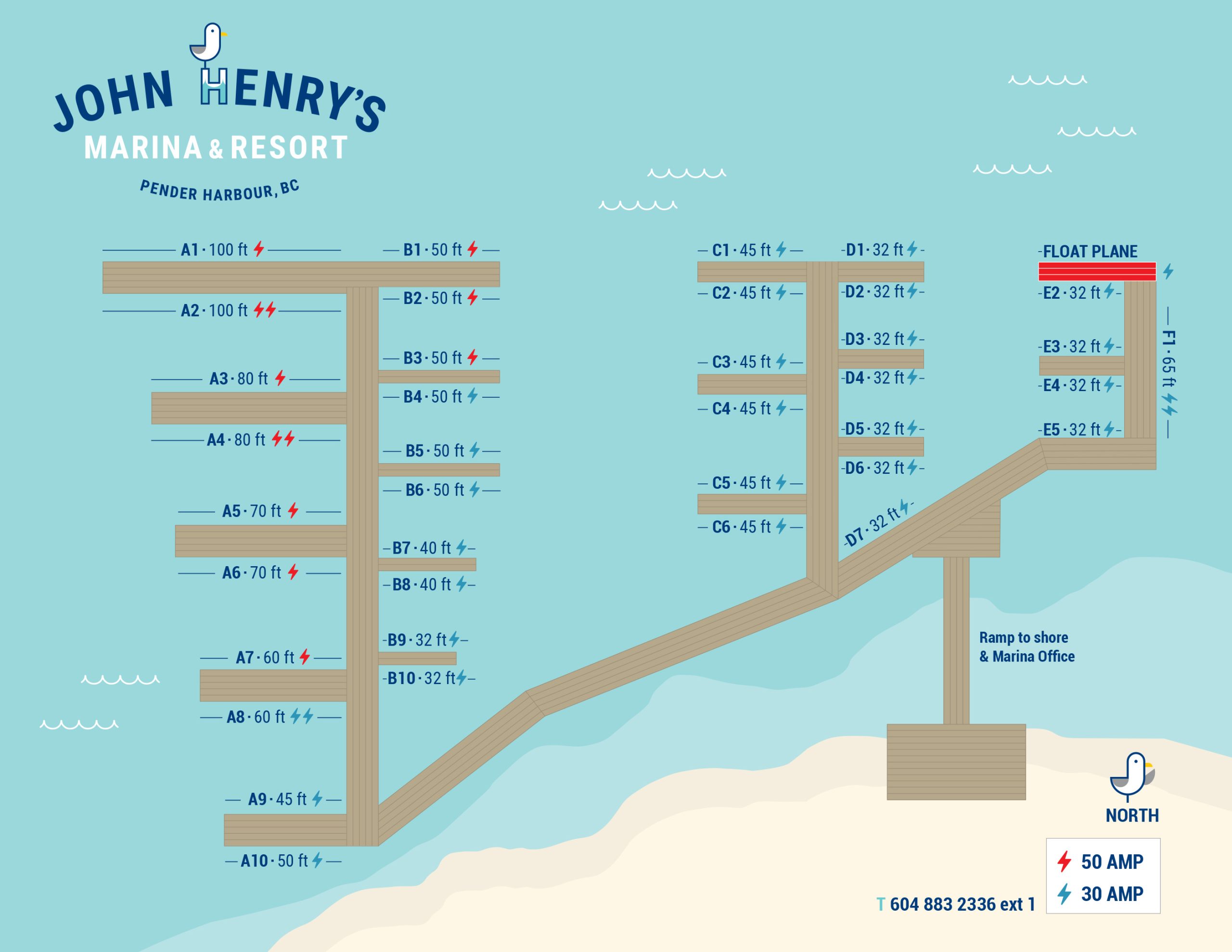
+ Click image to view larger
+ Click image to view larger
GPS Location Coordinates
Latitude: 49° 37.9’N
Longitude: 124° 2.02’W
Marine Charts: 3512 and 3535
VHF: 66A (Summer only)